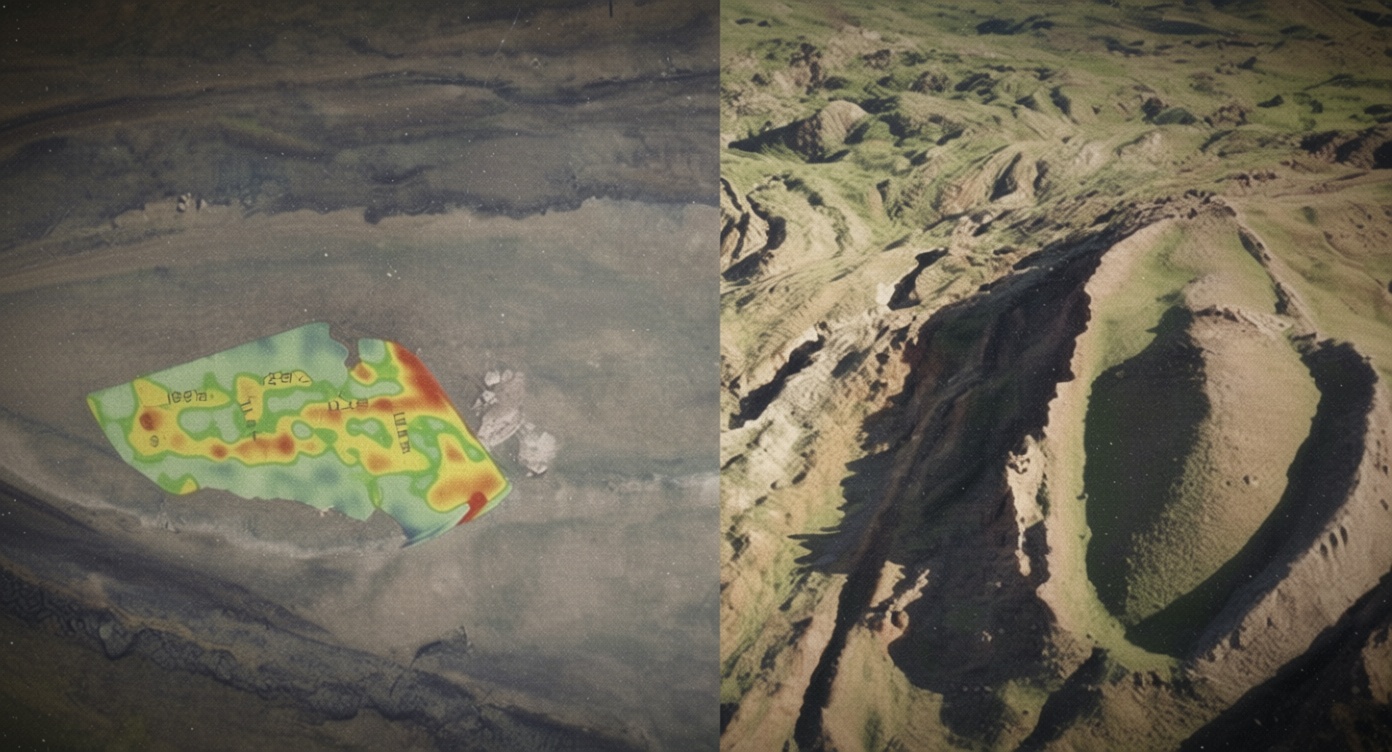
Reported Findings
Researchers examining Türkiye’s Durupınar Formation, near Mount Ararat, say ground-penetrating radar (GPR) surveys have detected subsurface features they believe could be consistent with the remains of a large, ancient structure. The team has reported angular formations, a possible cavity, corridors and what it describes as possible wood fragments and a “chemical imprint” beneath the ground.
The claims were publicized by Noah’s Ark Scans, a research group associated with independent researcher Andrew Jones. Speaking to the Christian Broadcasting Network, Jones said the team does not expect to find a fully preserved vessel. “What’s left is the chemical imprint, pieces of wood and in the ground, the shape of a hall,” he said. According to the reports, radar data may show a central passage measuring approximately 13 feet, along with side corridors or chambers.
Connection to the Biblical Account
The reported radar patterns have been interpreted by proponents as potentially matching the biblical description of Noah’s Ark. The Book of Genesis describes the vessel as having lower, second and third decks, and the research team says its scans appear to show three distinct underground layers. Genesis 6:16 states: “Make a roof for the ark, and finish it to a cubit above, and set the door of the ark in its side. Make it with lower, second, and third decks.”
Biblical measurements describe the ark as 300 cubits long, 50 cubits wide and 30 cubits high—often estimated at roughly 515 feet long, 86 feet wide and 52 feet high. The Durupınar Formation’s elongated shape has led some observers to argue that it resembles those proportions. The site lies about 18 miles south of Mount Ararat, a location frequently associated with the biblical phrase “the mountains of Ararat.”
A Long-Running Archaeological Dispute
The formation became known to modern researchers during the 20th century after reportedly being exposed by heavy rainfall and seismic activity in 1948. A Kurdish shepherd later drew attention to the unusual structure. Since then, explorers, religious researchers and archaeologists have debated whether it represents a man-made vessel or a natural geological formation.
No conclusive archaeological evidence has established that the Durupınar Formation is Noah’s Ark. Skeptics have argued that its shape can be explained by geological processes, including erosion, sediment movement and the deformation of rock. The site’s proximity to Mount Ararat has also fueled speculation, but geographic association alone does not demonstrate that a biblical event occurred there.
What the Radar Can—and Cannot—Show
Ground-penetrating radar sends electromagnetic signals into the ground and records reflections from changes in material density and composition. It can help map buried structures, voids and layers without excavation, but radar images generally require corroboration through controlled digging, laboratory analysis and independent review. Anomalies interpreted as corridors or wood may also result from naturally occurring fractures, sediment boundaries or other geological features.
The reported observations therefore represent preliminary claims rather than a verified discovery. Confirming the presence of ancient timber would require securely dated samples, analysis by independent specialists and evidence that any material belongs to a deliberate, large-scale structure. Until such work is completed and the findings are subjected to transparent scholarly scrutiny, the Durupınar Formation will remain an intriguing but disputed candidate—not proven evidence of Noah’s Ark.


