Overview
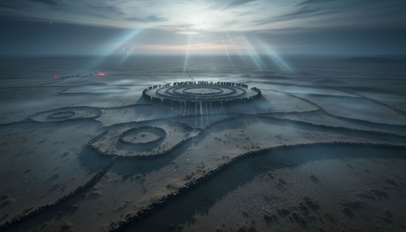
The stone circle of Rujm el‑Hiri, long celebrated as the “Israeli Stonehenge,” has once again become the focus of intense scholarly debate. Situated in the Golan Heights, the basalt monument—often described as the “Wheel of Spirits”—has puzzled archaeologists for more than half a century regarding its age, function, and cultural context. Until now, researchers treated the site as an isolated phenomenon, lacking comparable structures in the surrounding landscape. A fresh aerial survey, however, reveals that Rujm el‑Hiri is part of a much larger, previously undocumented complex of stone enclosures and circles that stretches across a 25‑kilometre radius.
New Findings
A team from Ben‑Gurion University of the Negev, together with collaborators from the University of Luxembourg, Tel Aviv University, Azerbaijan University and the Israel Antiquities Authority, identified nearly 30 additional circular stone structures using high‑resolution satellite imagery. These features, most exceeding 50 meters in diameter, share a common design: concentric basalt walls, connecting passages, and internal partitions built from locally sourced fieldstones. The researchers documented a mixture of field walls, enclosures, and stone piles, many of them barely visible on the ground because later construction phases repurposed the basalt blocks. “What we are seeing is a patterned landscape that was deliberately engineered, not a random scattering of stones,” said Dr. Michal Birkenfeld, lead author of the study.
Methodology
The discovery hinged on advances in remote‑sensing technology that allow archaeologists to examine terrain under varying seasonal conditions, vegetation cover, and lighting angles. By comparing images captured in winter, when vegetation recedes, with summer shots, the team could isolate linear and circular anomalies that correspond to human‑made features. The satellite data were cross‑checked with limited ground verification, confirming that the identified shapes correspond to stone constructions rather than natural rock outcrops. The study, published in PLOS ONE, emphasizes that many of the newly mapped sites suffer from poor preservation, a consequence of centuries of stone reuse and erosion.
Implications
The broader distribution of stone circles challenges the long‑standing view of Rujm el‑Hiri as a singular, anomalous monument. Their consistent placement on gentle slopes or small plains near seasonal watercourses suggests a deliberate integration with the natural hydrology, possibly for ritual, calendrical, or communal purposes. Moreover, the scale of the structures—some rivaling the central circle in size—implies a coordinated effort by a sizable community or successive groups over an extended period. “If these sites are contemporaneous, we may be looking at a regional cultural tradition that has left virtually no written record,” noted Prof. Lev Eppelbaum, a co‑author and specialist in geo‑archaeology.
Next Steps
While satellite imaging has opened a new window onto the Golan Heights’ prehistoric landscape, the authors stress that systematic excavation is essential to establish chronology and function. Planned field seasons will target a representative sample of the newly identified circles for stratigraphic testing, radiocarbon dating, and material analysis. Such work could clarify whether the monuments belong to the Late Chalcolithic, Early Bronze Age, or a later period, and whether they were used for astronomical observation, burial, or social gatherings. As the research progresses, the “Israeli Stonehenge” may evolve from an isolated curiosity into a keystone for understanding the ancient peoples who once shaped this rugged terrain.